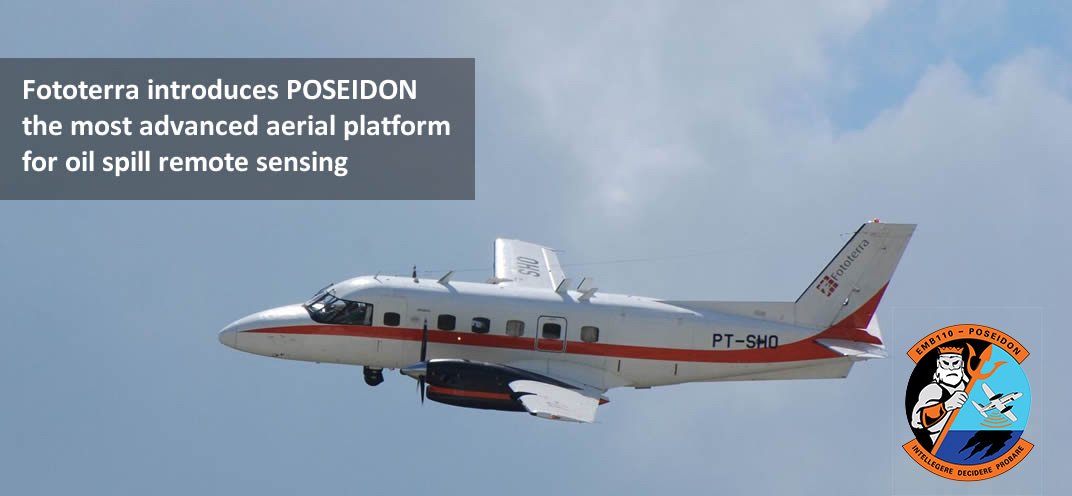
POSEIDON is an advanced data acquisition and processing system for airborne maritime surveillance, specifically for Oil Spill and Pollution monitoring, detection and real time identification.
The philosophy behind POSEIDON is to provide intelligence on the scene, which means understanding the environment, deciding on appropriate actions and controlling the results. Industry and government responders need immediately to know the common operating picture with clear, usable, real-time information.
POSEIDON integrates multiple airborne remote sensors and mission system components into one user friendly, network-based data acquisition and processing system. The integrated multisensor environment, data processing and real-time communication are the foundation of the POSEIDON platform.
The multi mission platform tasks include: Airborne maritime surveillance, Airborne oil spill remote sensing, Search & Rescue.
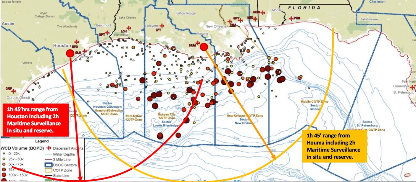
With 5 hr. of mission time, POSEIDON can fly up to 1,100 naut. mi. in a single mission. This allows coverage of any block in the Gulf of Mexico in a single mission from the home base in Texas or Louisiana. From Houston, the aircraft can be repositioned within 10 hr. anywhere in the West or East Coast in the Caribbean and Central America.
Readiness is also crucial. Aircraft and equipment are ready for deployment on a 24/7 basis with an integrated team of pilots and operators highly trained and coordinated. The aircraft is ready for dispatch within 1 hr..
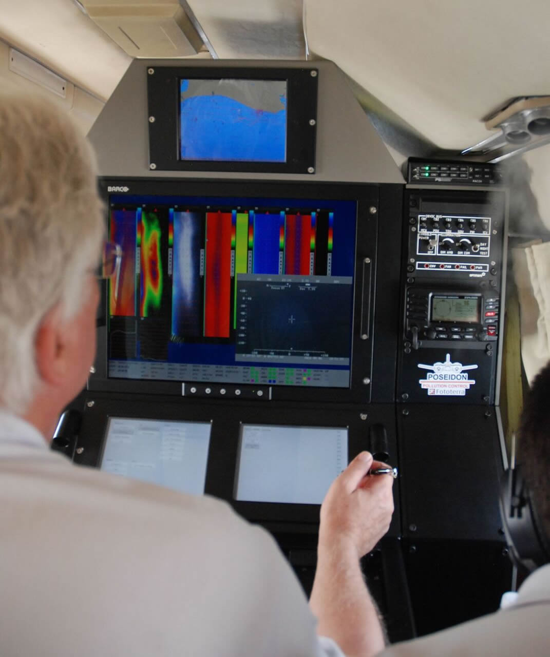
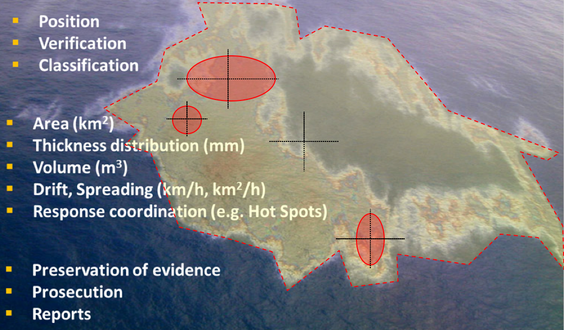
The information that the POSEIDON platform provides from various sensors and real-time data processing and analysis includes: far-range detection of surface films (oil and pollutants and natural substances); the area of the spill; the coordinates of the center of the oil spill or the patches of oil; definition of the polygon of interest; mapping of relative thickness; classification of oil and pollutants; oil weathering information; measurement of absolute thickness; volume of the spill; definition and localization of the hotspots, which are areas inside the spill where the bulk of oil is concentrated; and day and night video recording of the scene.
Additionally, the analysis of multitemporal data allows deriving of the dynamic properties of the spill, such as the drift and spreading of the oil on the sea surface.
All the information is georeferenced and integrated with additional layers of data from a direction finder, AIS or satellite imagery, allowing the creation in real time of the complete scene.
All the data are processed and made available in real time during the flight. This enables the operator to continuously report to the Incident Command Center to support the decision-making process with the most current data and report to the ship-based responders to improve the oil recovery process.
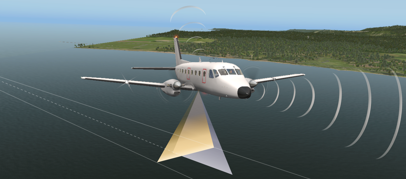
POSEIDON’s primary communication system is based on an innovative broadband radio system that allows digital high-speed communication and data transfer between the aircraft and other assets on the scene. Real-time mission coordination is crucial for efficient and safe operations and to enable the responders to have a common operating picture of the spill and allow them to plan the best strategies and tactics for the response. Real time processed data can be easily uploaded in any GIS platform or shared in a dedicated website.
Real-time, processed, quantitative information allows responders to manage the response based on facts, have a common operating picture, improve safety an reduce costs through efficient utilization of resources, conduct natural resource damage assessment, verify the effectiveness of restoration plans, and preserve evidence.
During the preparedness phase, aerial support also plays a fundamental role. Proactive surveillance programs provide response staff with familiarity on the capabilities and limitations of the methods employed. Exercises involving airborne platforms help to insure readiness and increase confidence that the responder community is prepared to respond immediately and effectively in the event of a spill.
Periodic and planned surveillance flights allow assessment and quantification of oil spills in the early stages, resulting in substantial savings in the overall cost of the recovery.
Aerial remote sensing allows independent monitoring of coastal water or infrastructure discharges and managing of potential significant risks for human health and the environment, giving confidence and peace of mind to the general public, media and governments.
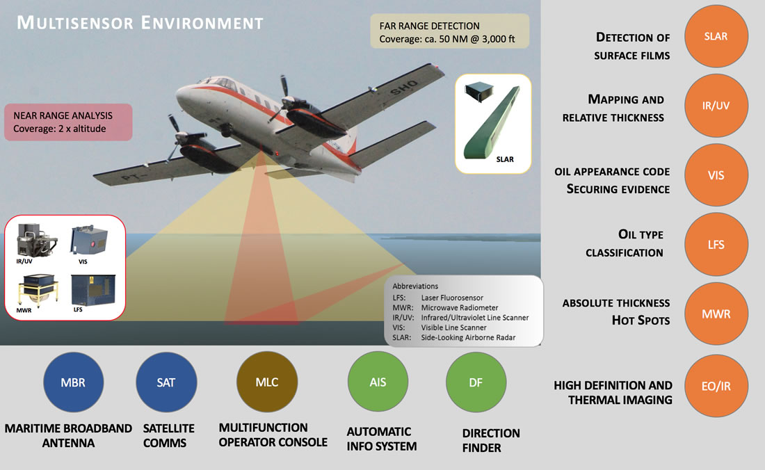
Far Range Detection Sensors: SLAR Side-Looking Airborne Radar: SLAR is the primary tool for wide-coverage oil spill detection. SLAR is a cloud penetrating X-band radar for detection of surface targets. Swath is about 50 Miles.
Tactical Direction Finder: Airborne Radio Direction Finder for Scanning of SAR frequencies.
Near Range Detection Sensors: Near Range sensors allow for an accurate analysis of the Oil Spill. Each sensor detects specific features of the spill for a precise target definition.
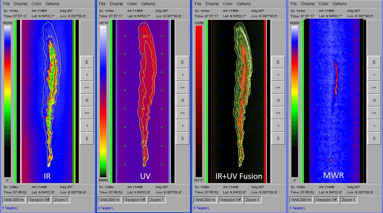
IR/UV Infrared Ultraviolet line scanner: Night and Day spill detection, used for highly precise measurements and hot-spot analysis.
VIS Visual line scanner: used for acquisition of highly resolved geo-referenced RGB images.
MWR Microwave Radiometer: line scanning microwave imager for detection of thick oil spill areas. It allows absolute measurement of thickness and volume of the spill.
LFS Laser Fluorosensor: fluorescence LIDAR for detection and classification of oil, petroleum products and specific chemicals.
EO/IR Electro Optical Infrared: used for identification and documentation during day and night. Used for prosecution and preservation of evidence.


© 2017 Fototerra Aerial Survey LLC

